")
")


 1
1 2
2 3
3 4
4 5
5 6
6 7
7 8
8 9
9 10
10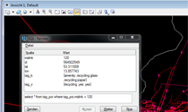
Article dated 03.12.2012
Since 2004 there is OpenStreetMap. This is a similar to handle project like Wikipedia, with the goal of creating a free world map. Everyone has free access. Anyone can help to make it grow, that errors will be corrected in the short term and that any (no upper limit) collected a variety of information about roads, railways, rivers, forests, buildings, etc.
Use in MicroStation OpenStreetMap
Since there are e.g. Dog owners that the dog excrement bags donor register for their city. Wheelchair receive informations for barrier-free movement. Tourists can find points of interest, landmarks, which are draw in as points of interest. The OSM maps are now available for Smartphones and GPS navigation systems over the Internet quickly loadable available. Cyclists routes are of interest too. Since the volunteers constantly and world wide variety of data register, the project kept growing
So it is only logical even from other CAD / GIS -.. Systems to get access to the data
For 'my 'CAD system MicroStation import the OSM data was, therefore, an interesting challenge for me. Surveyors, architects, urban planners and landscapers who work with MicroStation, have an interest to include the OSM data in their system. Practical hand a referenced DGN is with all OSM informations a useful addition to the work itself measured data.
The MDL OSM2DGN.MA has been developed for the MicroStation V8i version. (However, it can be implemented on request for every older platform.)